Mapping Danger
After disasters like Monday’s earthquake in central Italy, attention often turns to the puzzle of predicting and preparing for such tragedies.
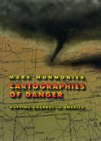
Maps, Mark Monmonier points out, play an important role in this process. In Cartographies of Danger, he explains that maps can tell us a lot about where to anticipate certain hazards — but they can also be dangerously misleading. California, for example, takes earthquakes seriously, with a comprehensive program of seismic mapping. But as 1994’s Northridge earthquake demonstrated, even reliable seismic-hazard maps can deceive anyone who misinterprets “known fault-lines” as the only places vulnerable to earthquakes.
How should we go about making the safest decisions?
Upon the book’s publication, NBC News recommended that “no one should buy a home, rent an apartment, or even drink the local water without having read this fascinating cartographic alert on the dangers that lurk in our everyday lives.” We recommend that you start here, with Monmonier’s list of Ten Risky Places.