The world beyond—and before—MapQuest

If you are planning to travel this summer through unfamiliar territory, chances are that you’ll use MapQuest or Google Maps, if not a GPS, to guide you—at least, you will if you’re anything like Regina Robins Flynn’s travel writing students.
In the current Chronicle of Higher Education, Flynn reflects on the ways that new technologies have changed how travelers look at (or don’t look at) maps and, by extension, the terrain they traverse. Talking to her students about an assignment that required them to write about a trip they had just taken, she “took an informal survey in class: ‘Who reads maps?'” The answer? “No one.”
It’s not exactly news that, as Flynn puts it, “people nowadays—and not just young people—do not like to encumber themselves with Rand McNally or Michelin books of maps, displaying every state in the union. Instead, they go to their laptops, print out directions to wherever they are going, and they’re off.” But it’s easy to forget, now that map-guided journeys can evoke such powerful nostalgia—Flynn remembers “being a kid traveling in my family’s nine-passenger station wagon,” where she’d “sit in the front seat and unfold all the crinkly creases, laying the maps out along the dashboard, dreaming of all the places I’d go”—that they were also once a new and paradigm-shifting phenomenon.
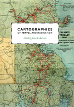
The beautiful Cartographies of Travel and Navigation reminds us, though, that with the exception of navigational sea charts, the use of maps by travelers only became common in the modern era. Highlighting the ways in which the travelers, operators, and planners of modern transportation systems used maps as both navigation tools and as representatives of a radical new mobility, the book brings the cartography of travel—by road, sea, rail, and air—to the forefront.
It puts in historical context the way Flynn’s students responded when she brought an armload of maps to class:
As I spread them out before my students, their eyes widened in amazement. There we were, in our classroom in the small harbor city of Salem, Mass., snug against the great Atlantic Ocean. To our north lies Canada; to the south, Argentina; far, far to the west, China; and to the east, Spain. We were literally unfolding the world in which we live, beginning to dream—as only maps allow us to dream, to imagine what lies beyond our borders.
Considered in those terms, our rich and eclectic list of books on maps and cartography offer enough fuel to power imaginative travels though the summer and long after—even if you’re not able to go far enough physically to ever need Google Maps.